These days, drones and UAV imagery are commonplace. Just about anyone with off-the-shelf LIDAR software can create a point cloud. That’s the easy part. Taking that point cloud, the extra mile to a design level map is an art and a science, requiring deep expertise and specialized photogrammetric software.
At DAS, our LIDAR data processing is bolstered by over 40 years of experience in creating design level maps and proprietary techniques for bringing LIDAR data to life with a mix of customized, manual processing and automated filtering. In a previous article, we discussed why automated UAV data processing packages can never provide a push button solution or replace battled-tested techniques and tools. In this post we provide an example of taking a raw point cloud the extra mile.
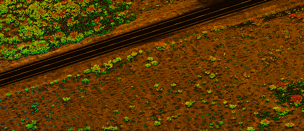
DAS’ proprietary LiDAR processing delineates individual vegetation as small as 1.0’ in height, as seen below:
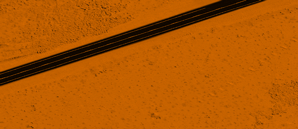
As a result, vegetation can be removed to provide an accurate Bare Earth surface without time consuming manual clean up:
Bottom line: there simply is no substitute for the accuracy and customization that comes with expert manual processing leveraging photogrammetric software and hardened techniques for automating manual and repeatable steps. DAS processes and prepares the data to meet specific client or project requirements. We can deliver digital assets that include DSMs, point clouds, high-resolution video and still imagery, orthophotography, and other specialty data types in industry-standard formats.